-
 PUGLIA REGIONCase history
PUGLIA REGION
Automatic Detection and Early Warning System for Wildfire Outbreaks
REQUIREMENTS
The intensification of global warming, characterized by increasingly prolonged periods of drought and extreme heatwaves, has significantly increased the risk of wildfire ignition, while also promoting faster fire spread. These phenomena are causing increasingly severe and difficult-to-manage environmental, social, and economic consequences.
In this critical and emergency context, the use of innovative technologies plays a fundamental role in enhancing and improving the effectiveness and efficiency of civil protection systems, particularly in prevention, monitoring, and rapid response activities. From this perspective, the Civil Protection Section of the Puglia Region, one of the Italian regions most affected by wildfires according to data from the European Forest Fire Information System (EFFIS), launched a tender for the implementation of an automatic wildfire detection and early warning system.
The system was designed to be installed in the Ionian Arc area, located to the west and northwest of the city of Taranto, a territory that is particularly environmentally fragile and increasingly exposed to wildfire risk. The presence of an advanced monitoring system aims to strengthen prevention and response capabilities in critical situations, reducing response times and contributing to the protection of the environment and public safety.
The project was funded under the Puglia Regional Operational Programme (POR) ERDF/ESF 2014–2020.
FEATURES
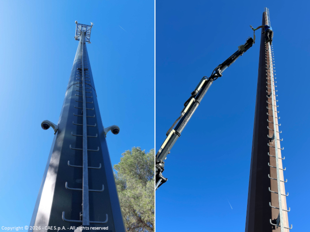
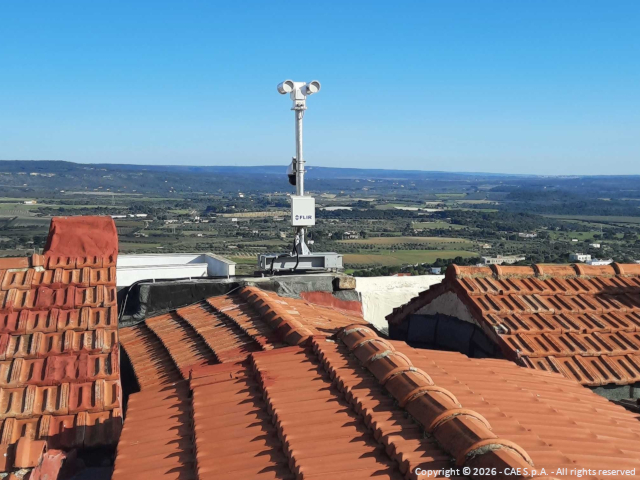
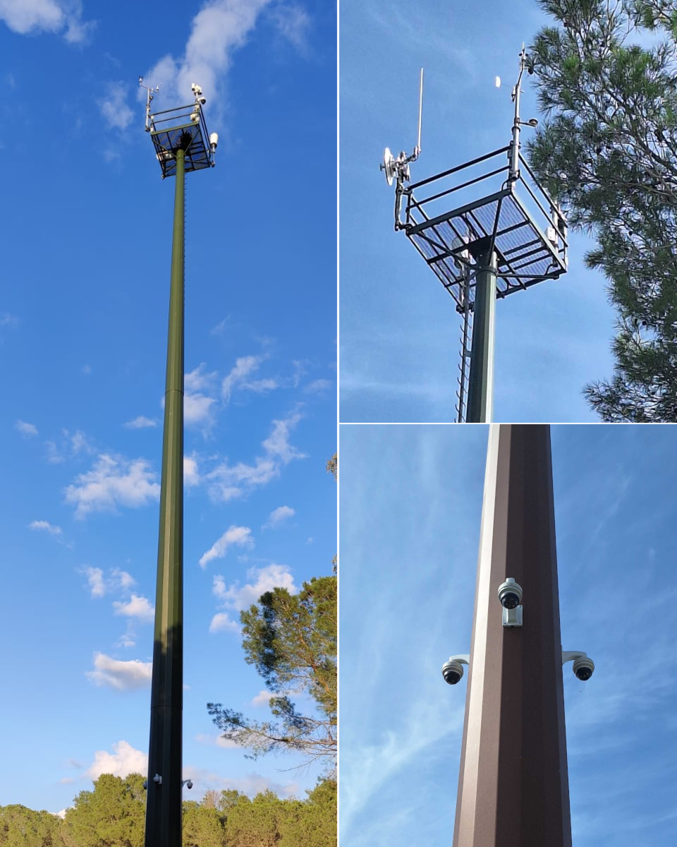
The system developed by CAE relies on stations equipped with meteorological sensors, cameras, and next-generation thermal imaging cameras, all connected to a control center with dedicated software, including Fi.De.Sys, which enables the analysis of video streams from detection stations to identify fires and instantly alert operators.
In the event of ignition detection, the system:
- triggers an alarm;
- geolocates the fire;
- displays it, including on a map;
- automatically directs the camera toward the detected hotspot;
- waits operator confirmation of the actual fire.
The system stores footage from before and after detection, enabling analysis of the causes (natural or human-induced) that triggered the fire. It also allows tracking of the fire front’s evolution.
The fire management system also integrates video surveillance cameras that continuously transmit images to the control room. As with the entire system, their presence also acts as a deterrent.
The system ensures 24/7 monitoring and early fire detection within a 10 km range, while enabling assessment of fire evolution, reducing false alarms, and optimizing response times and public safety.
COMPOSITION
The system integrates all the necessary elements for monitoring the various risk factors of a territory and specifically consists of:
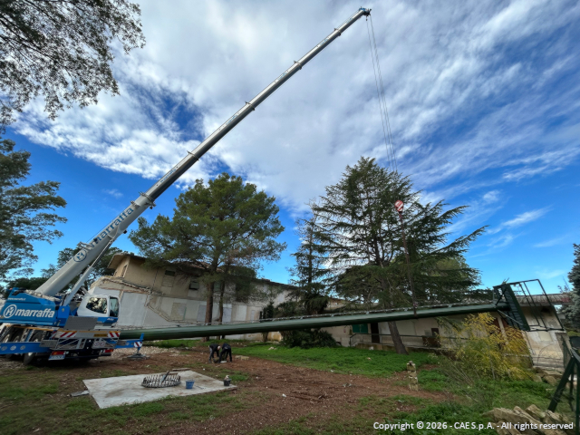
- 6 monitoring stations: equipped with optical systems (thermal cameras, HD cameras, and dome cameras); each station includes a security system with video surveillance devices and intrusion detection sensors;
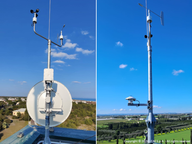
- 6 monitoring stations: equipped with Mhaster dataloggers and meteorological sensors for measuring temperature, humidity (THS thermo-hygrometer), rainfall (PG10 rain gauge), pressure, radiation, and wind;
- 1 switching node (Central Hub): located in Mottola, acting as a logistical hub for collecting data from peripheral stations;
- 1 microwave transmission network: ensuring communication continuity;
- 1 operations center: located at the Regional Civil Protection headquarters in Bari-Modugno, where overall supervision and emergency coordination take place.