-
 NewsRoads at risk of flooding? Sardinia invests in technology and safety.
Roads at risk of flooding? Sardinia invests in technology and safety.
February 2020
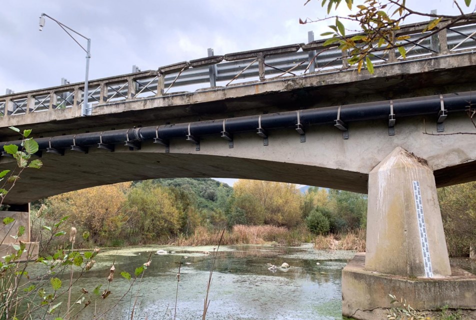
In November 2013, the passage of Cyclone Ruven, also known as Cleopatra, led to heavy rains and discharged 440mm of water on the region of Sardinia on the morning of November 18th, causing serious damages: overflowing of canals and rivers, deaths and destruction. Extreme events of this kind are increasingly more frequent and consequently risk mitigation interventions have become necessary. After the approval of the Draft Agreement between the Autonomous Region of Sardinia, Province of Nùoro and ANAS S.p.A. for the implementation - carried out by the latter company - of the provincial road interventions entrusted to the Province of Nùoro by the Autonomous Region of Sardinia, ANAS has issued a negotiated procedure for the implementation of INTERVENTION S1. CAE has been awarded the contract for the supply and installation of a real-time network aimed at alerting on the hydraulic and hydrogeological risk for Civil Protection purposes,with specific focus to safeguarding those who transit on the Provincial Road SP46, in the area at risk of flooding near the River Cedrino.
The response times of the River Cedrino are very fast, as are the transfer times of the flood wave (about 30 minutes). In this scenario, in order to guarantee the safety of those who transit through this area, it is essential to be able to apply the algorithms of CAE stations. When exceeding a certain threshold, these stations allow to activate traffic inhibition devices, even without the intervention of a control centre.
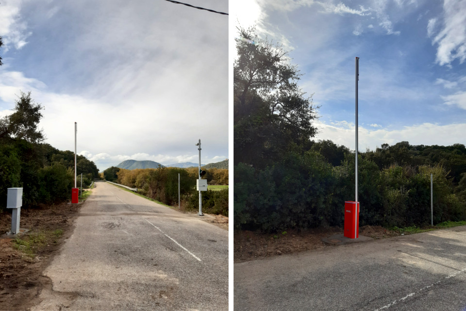
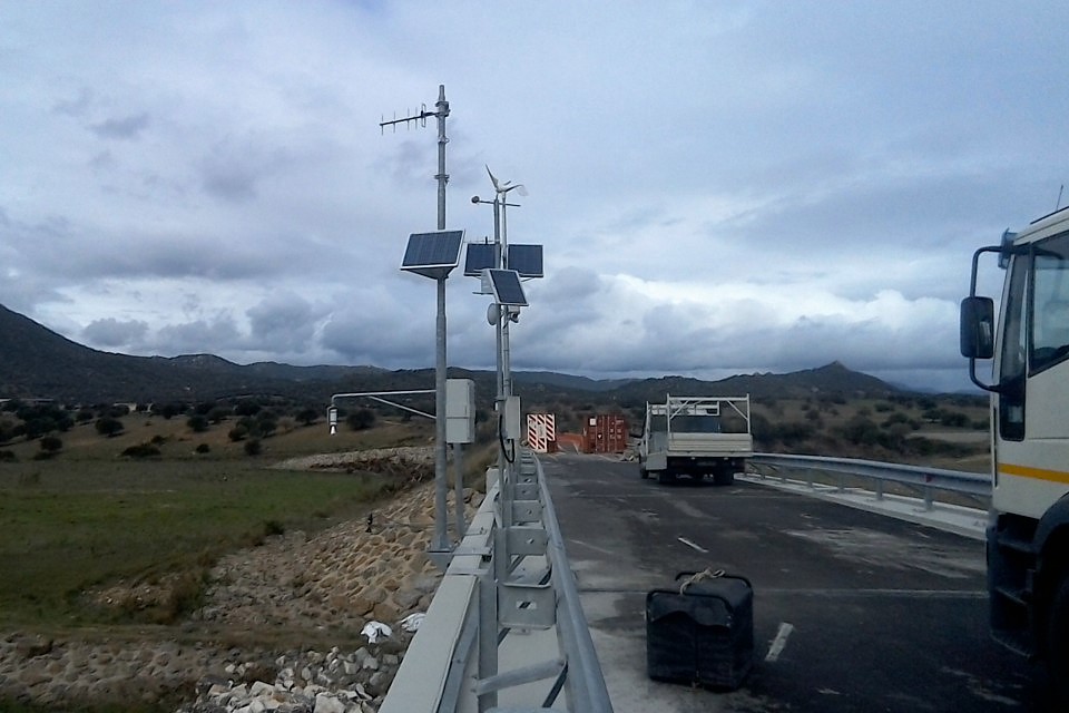
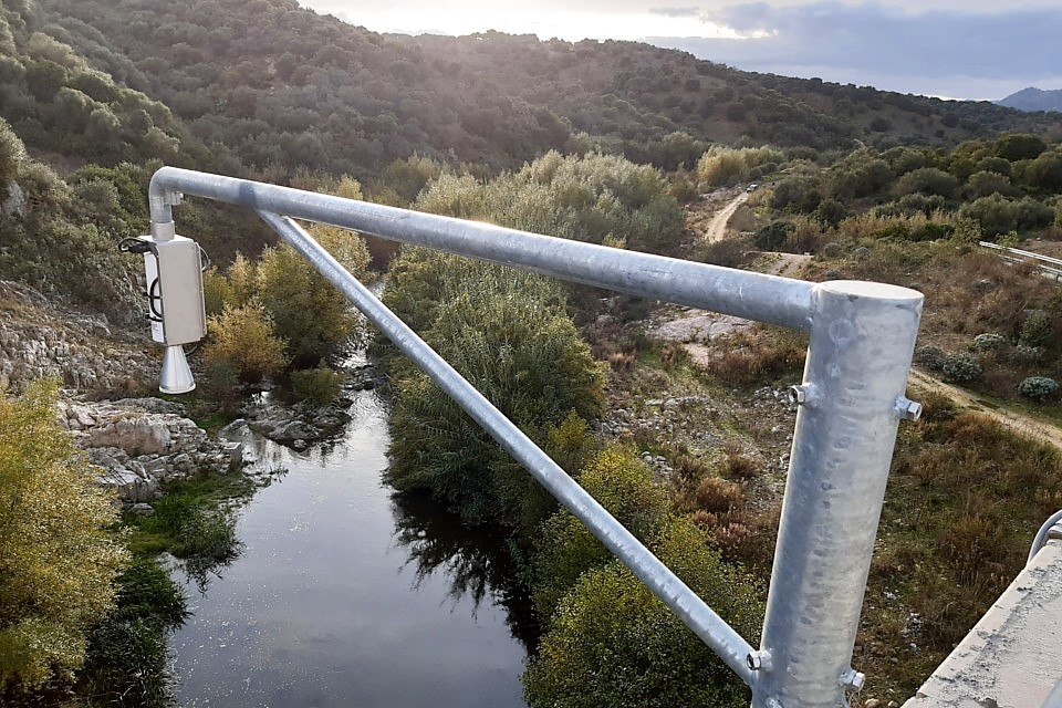
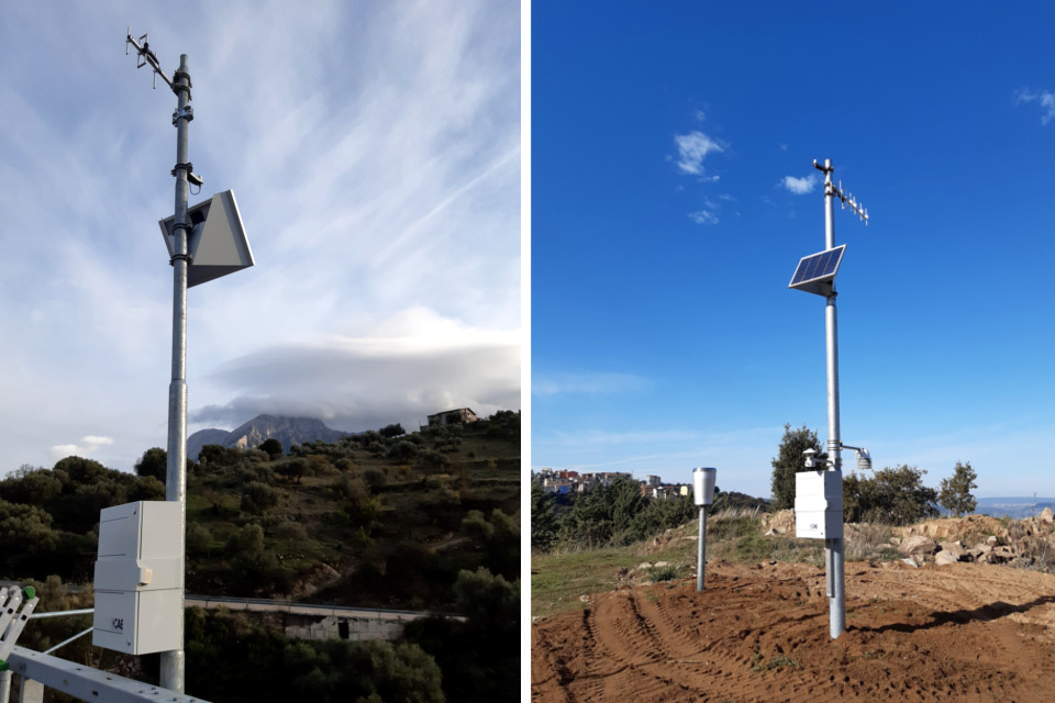
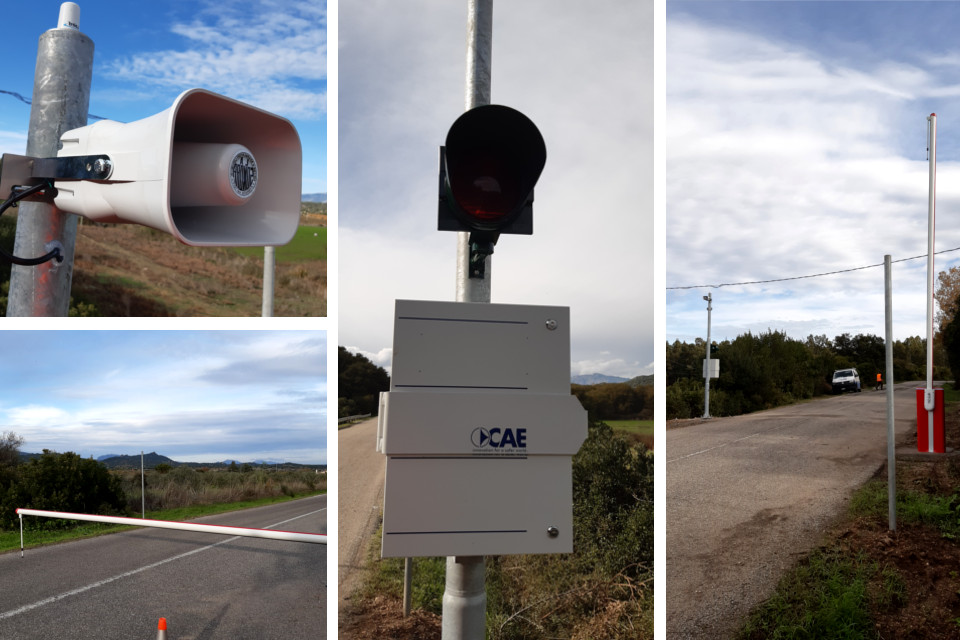
To meet the requirements of the project, CAE provided: five hydrometric stations, a meteorological station and an automatic system to inhibit traffic, consisting of two automatic barriers for the closure of the Provincial Road to the vehicular transit towards the Oloé bridge when the hydrometric levels exceed the thresholds of alert established by the Civil Protection Plans and the risk is high. The systems are connected to the Regional Radio Network managed by ARPAS/SASI, ensuring the reliability of the service even in extreme weather conditions.
This system has several purposes, specifically: the meteorological station will allow to increase the density of pluviometric information in the Cedrino Basin area, while all five hydrometric stations will contribute to define the Provincial Road closure thresholds, two of these are particularly strategic, as they are directly connected to the barriers and, therefore, it is possible to activate them automatically when the defined hydrometric thresholds are exceeded. Finally, the hydrometric station of the Rio Flumineddu is strategic to improve the calibration of the hydrological-hydraulic model of the Upper Cedrino Basin: from this improvement follow preventive assessments of calibration and forecast of flows and volumes flowed from Lake Pedra 'e Othoni, in addition to further considerations regarding the alert system of the Lower Cedrino area. To date, the system is about to be completed; the testing and integration to any effect on the Regional Civil Protection Network will follow shortly.
Back to the news index