-
 NewsMaratea: monitoring of the Castrocucco landslide
Maratea: monitoring of the Castrocucco landslide
March 2026
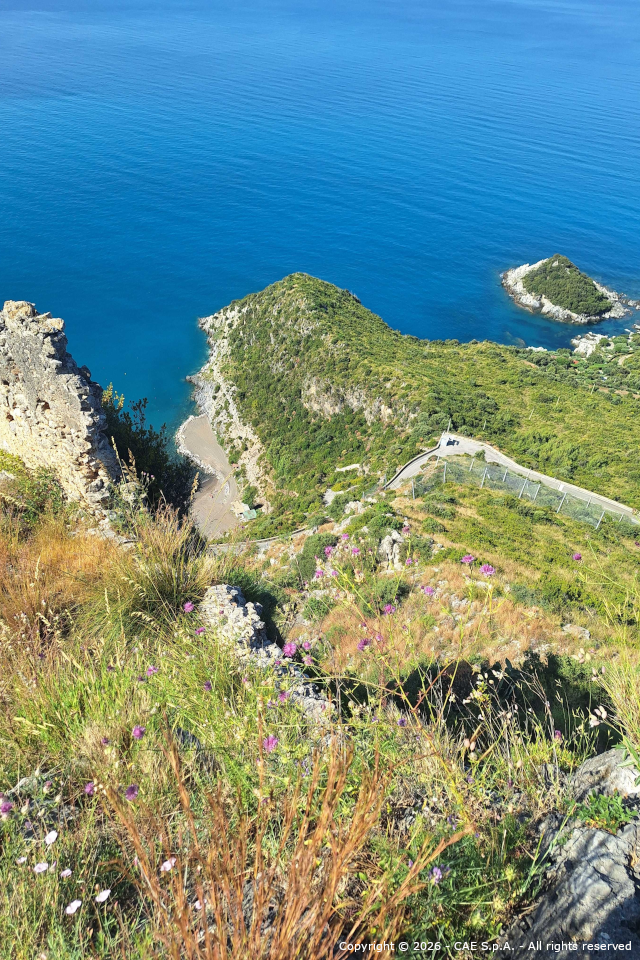
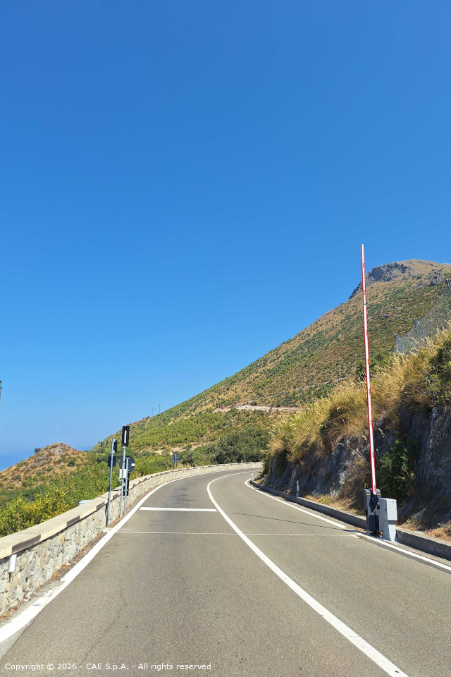
In Castrocucco, near Maratea, in the province of Potenza (Basilicata), on November 30, 2022, a landslide of significant intensity occurred, creating a serious threat to public safety. The event caused the collapse of a large portion of the rocky slope below the medieval castle of Castrocucco, resulting in the destruction of a section of State Road No. 18, the interruption of traffic, and the suspension of essential services.
This instability manifests itself in accidental and partially retrogressive rockfall phenomena. The causes of instability can be attributed to a combination of geological (predisposing) and meteorological (triggering) factors. From a geological point of view, the slope already exhibited a predisposition to instability: the rock face was highly fractured, with widespread discontinuities and fracture planes compromising its integrity. From a hydrogeological perspective, exceptional rainfalls play a decisive role in triggering debris detachment or in widening pre-existing fractures.
The landslide risk mitigation strategy in this context is based on an integrated engineering approach, combining structural interventions with remote monitoring and control logics. Alongside consolidation works on the most unstable blocks, measures to contain rockfall effects, bypass solutions for the existing infrastructure, and traffic management measures, a continuous monitoring and alerting system of slope phenomena has been implemented. Landslide monitoring represents a key element in managing hydrogeological risk and safeguarding public safety and infrastructure.
CAE, working in close collaboration with other appointed companies and professionals, such as the Department of Civil, Building and Environmental Engineering of the University of Naples “Federico II,” was commissioned in 2025 to assess the condition of the existing monitoring system, reactivating it, and maintaining it.
Thanks to site inspections and the valuable data collected over the years by the existing system, it was possible to identify further interventions to enhance the effectiveness and reliability of the system used up to that point.
As the system had to support not only monitoring purposes but also alerting functions, it was essential to restore the proper operation of all components and enhance the system to improve anomaly detection and response capabilities under critical conditions.
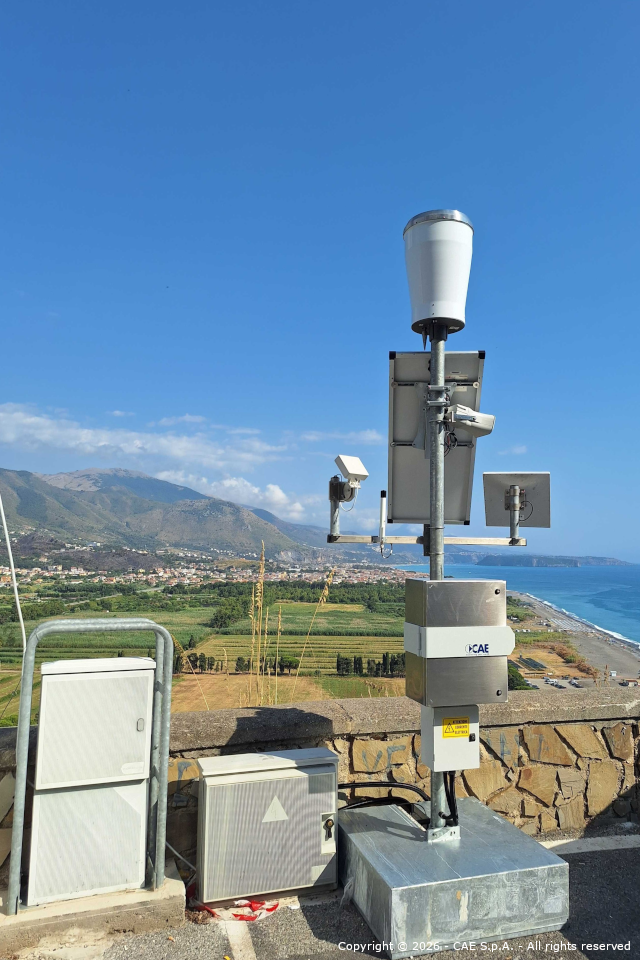
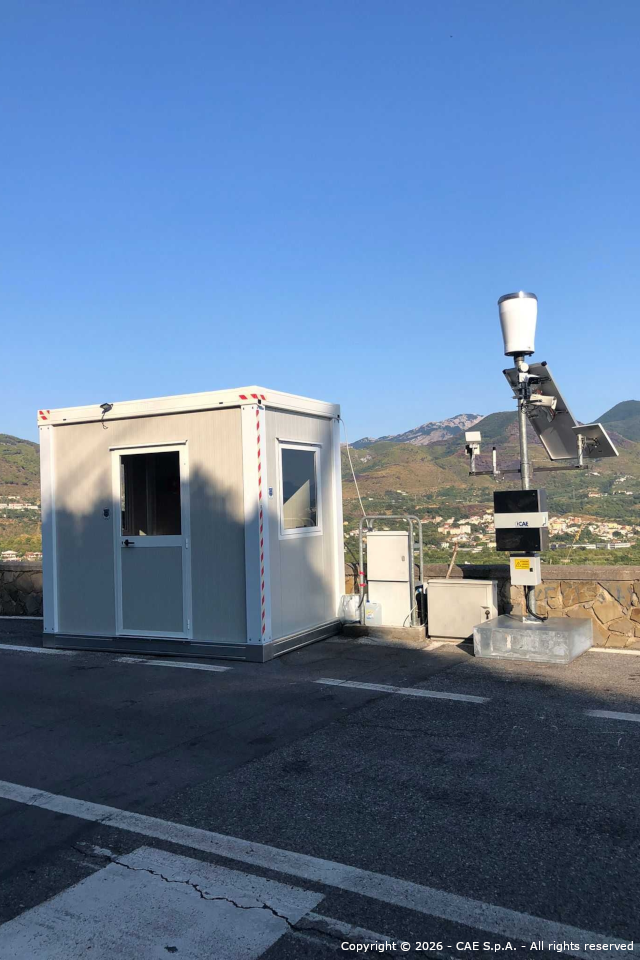
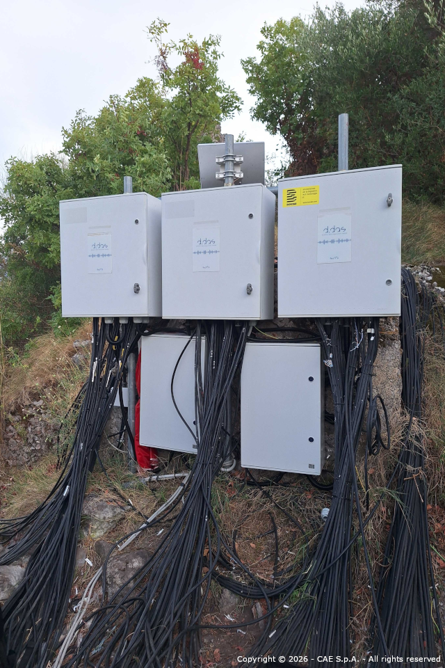
The resulting works, including upgrades and new installations, have led to a technologically advanced system composed of:
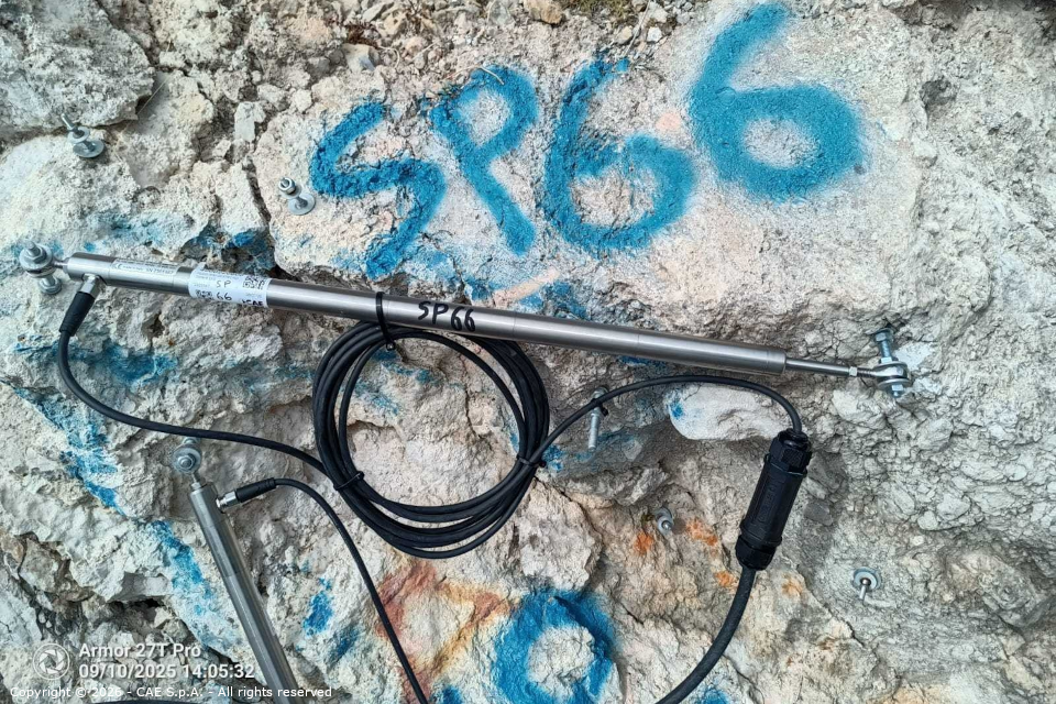
- 3 dataloggers managing more than 100 sensors, including crack meters, inclinometers, accelerometers, and velocimeters;
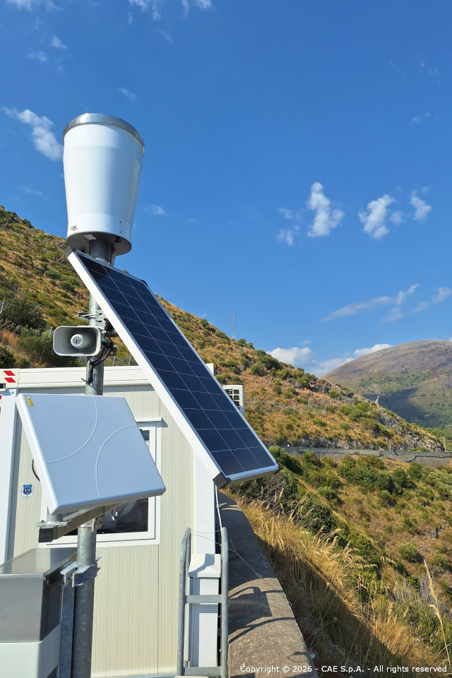
- 1 weather station;
- 2 rainfall stations used for the climatic characterization of the area triggering rockfall phenomena;
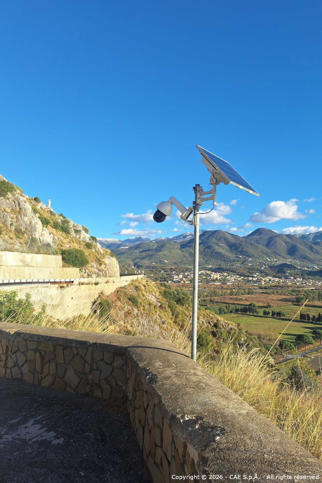
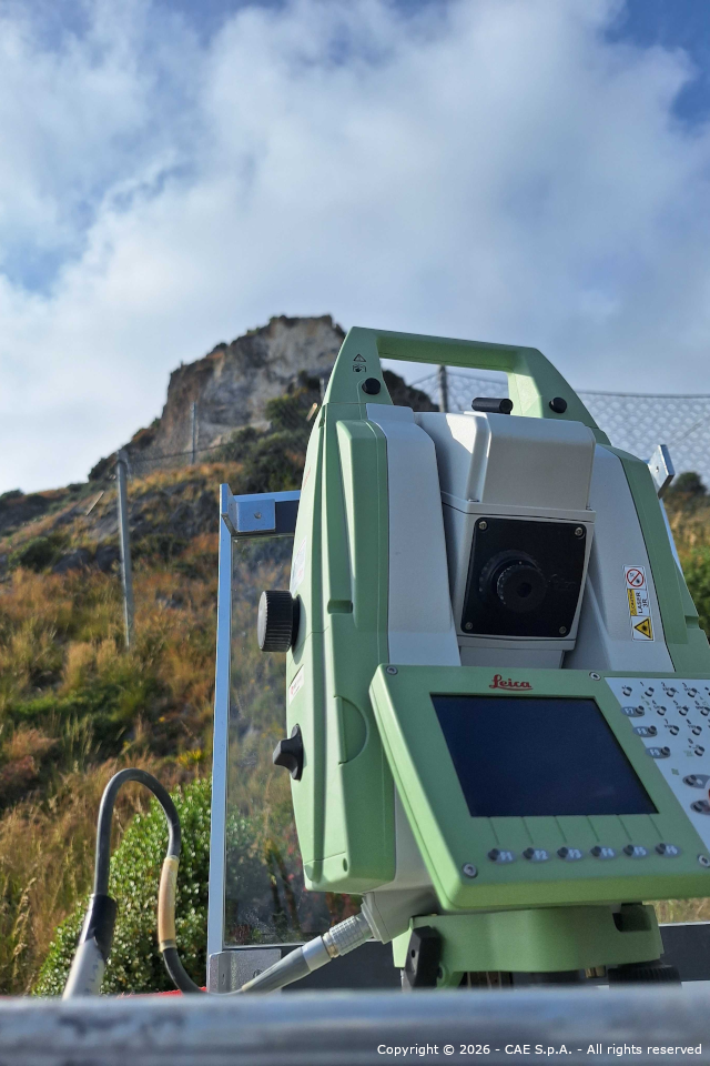
- 1 total station;
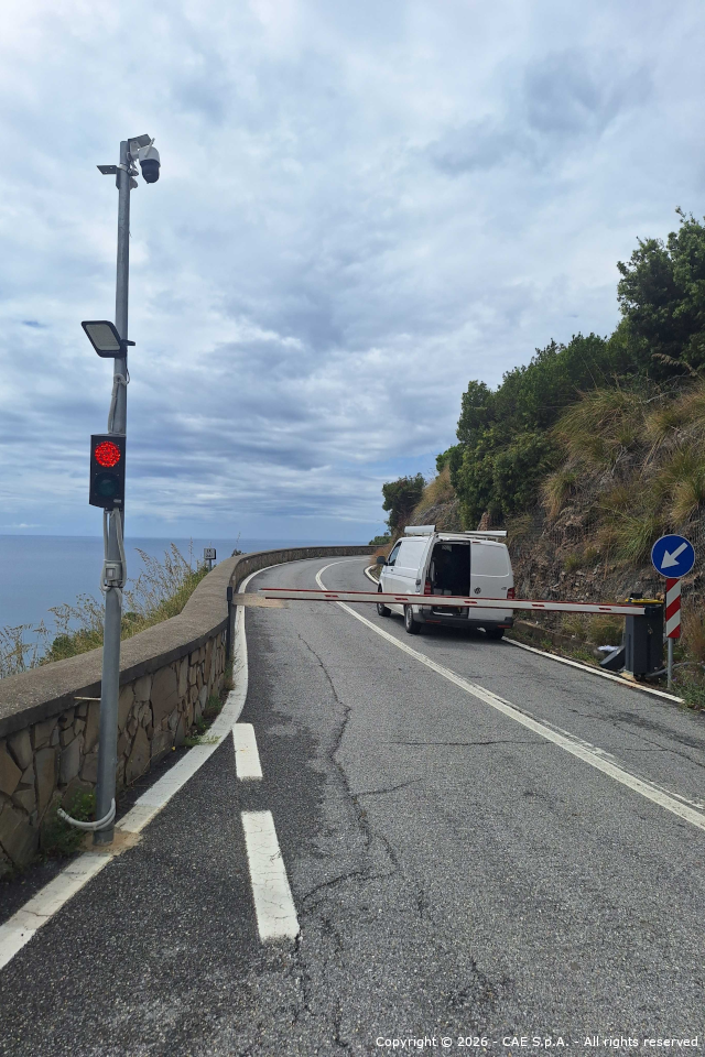
- traffic restriction devices at both ends of the at-risk road section, including 2 traffic lights, 2 electromechanical barriers, and 2 sirens for acoustic alerting;
- 1 cloud-based control center for remote system management, data visualization, and advanced alarm configuration.
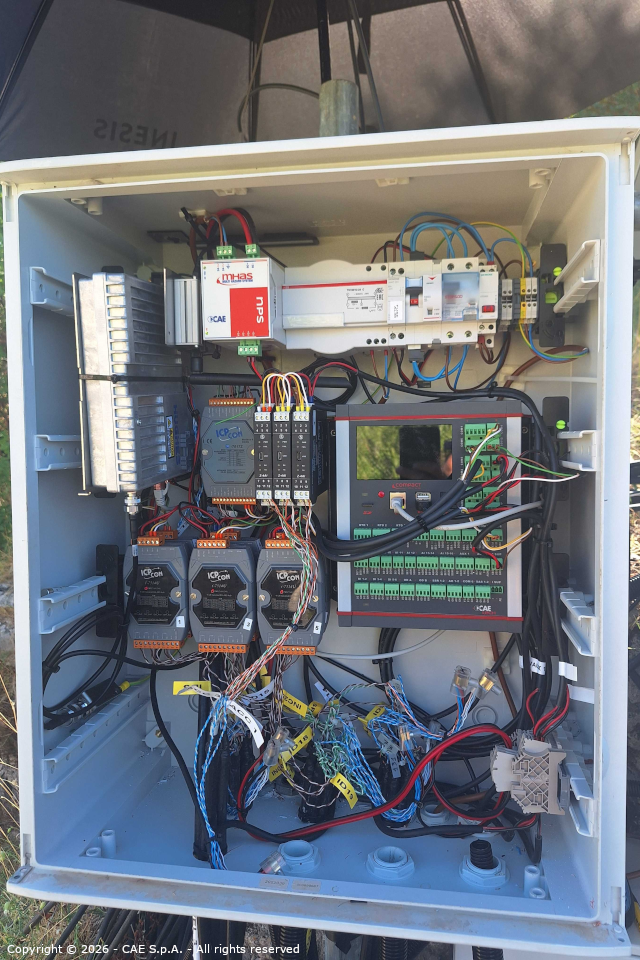
The newly installed technologies, including Compact dataloggers, allow:
- automatic activation of traffic restriction devices and redundant alarms, triggered when thresholds defined by the Administration are exceeded;
- reduced need for on-site interventions, thanks to advanced remote control and remote maintenance functions;
- reduced energy consumption, enabling the adoption of an autonomous solar power supply system. This ensures continuous operation 24/7, even in the event of power outages.
Furthermore, thanks to the implementation of a satellite module, data transmission has become even more stable and reliable.
Among the technologies used are Compact dataloggers, PG10 rain gauges, THS thermo-hygrometers, the total station, and AEGIS and Sentry software.
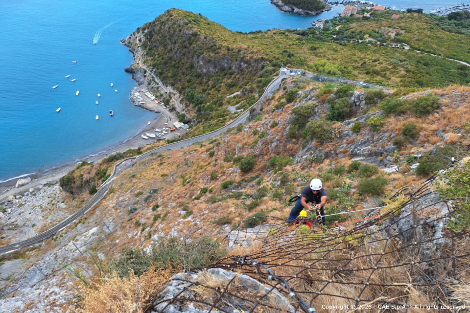
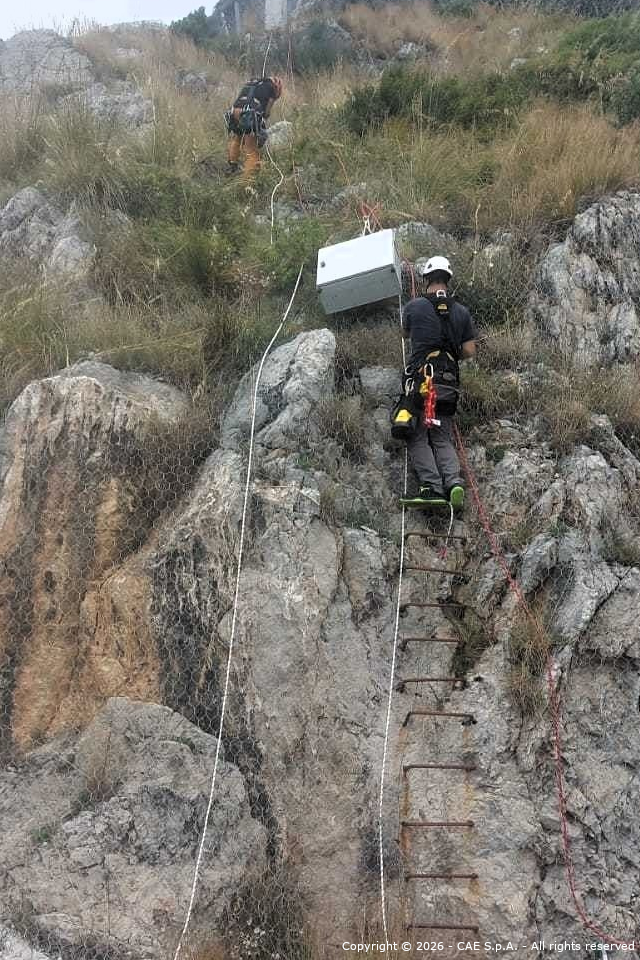
This is a complex project that has also required leveraging the specialized expertise of CAE technicians in rope work at height. The proposed upgrade of the monitoring system represents a significant step forward in terms of reliability, efficiency, and responsiveness to critical events. The newly introduced features will make it possible to optimize territorial monitoring, improve the quality and continuity of data flow, and provide more effective support to operators responsible for hydrogeological risk management.
Thanks to the commitment of all parties involved, under the supervision of the Extraordinary Commissioner for the Castrocucco landslide emergency in Maratea, as well as the Municipal Police Command, and based on a precise management protocol specifically designed for the characteristics of the monitored site, it has been possible to reopen the road, allowing vehicular traffic during specific time slots, with the possibility of temporary closures in the event of adverse weather conditions.
Back to the index