-
 PUGLIA REGIONCase history
PUGLIA REGION
New Monitoring Systems for Landslides and Sinkholes
REQUIREMENTS
In a complex and unstable territory such as Puglia, continuous monitoring of geological risk and landslide movements is a priority for public safety. The region includes areas that are vulnerable to hydrogeological instability, influenced by geomorphological characteristics as well as climatic and human factors. In this context, it is essential to have systems capable of continuously tracking the evolution of ground conditions. Monitoring makes it possible to detect early signs of instability, support operational decisions based on objective data, and strengthen strategies for adapting to climate change and extreme weather events.
FEATURES
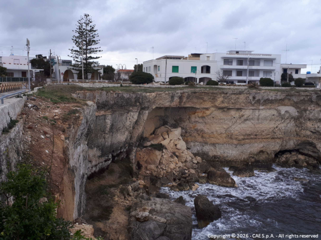
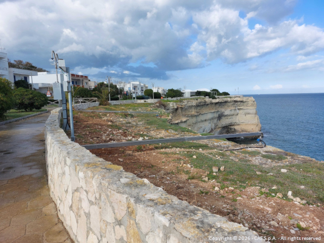
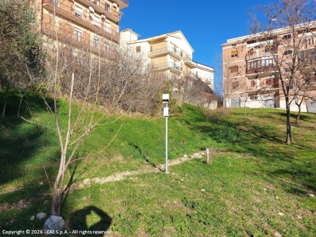
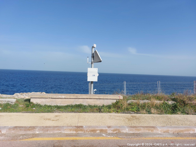
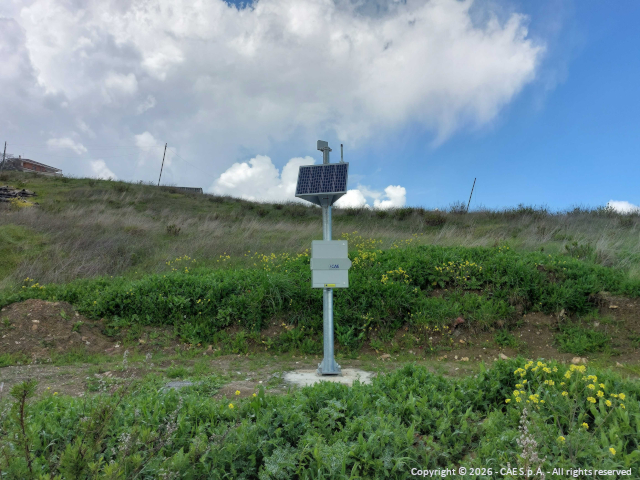
The project enabled real-time monitoring of five areas considered particularly critical, selected based on their high levels of vulnerability and geomorphological instability. Three of these areas are located in the Sub-Apennine Dauno region, specifically within the territories of Motta Montecorvino, San Marco La Catola, and along the Candela-Lacedonia section of the A16 motorway. A fourth site is located along the coast near Torre dell’Orso, an area representative of rock landslide phenomena, while the fifth is situated in the territory of Laterza, characterized by recurring ground subsidence events.
The main objective of the project is the implementation and deployment of advanced technological systems, integrated within a specialized software platform designed to collect, unify, coordinate, and interpret data streams from the various monitoring sites.
Overall, this set of high-precision technologies provided by CAE represents a significant operational support for the Civil Protection of the Puglia Region, making a substantial contribution to activities related to the prevention, monitoring, and management of natural risks. In particular, the system enhances the protection of the territory and the safeguarding of human life, thanks to its ability to detect early signs of instability and promptly activate the necessary safety measures.
COMPOSITION
Across the five areas mentioned above, CAE implemented a landslide monitoring system that includes:
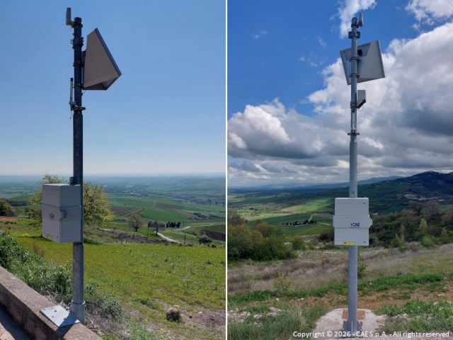
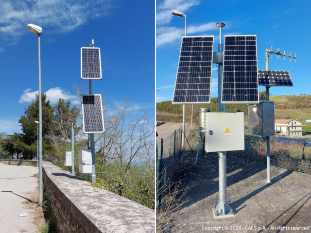
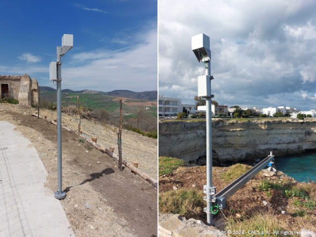
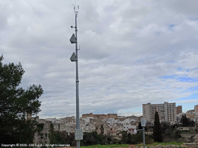
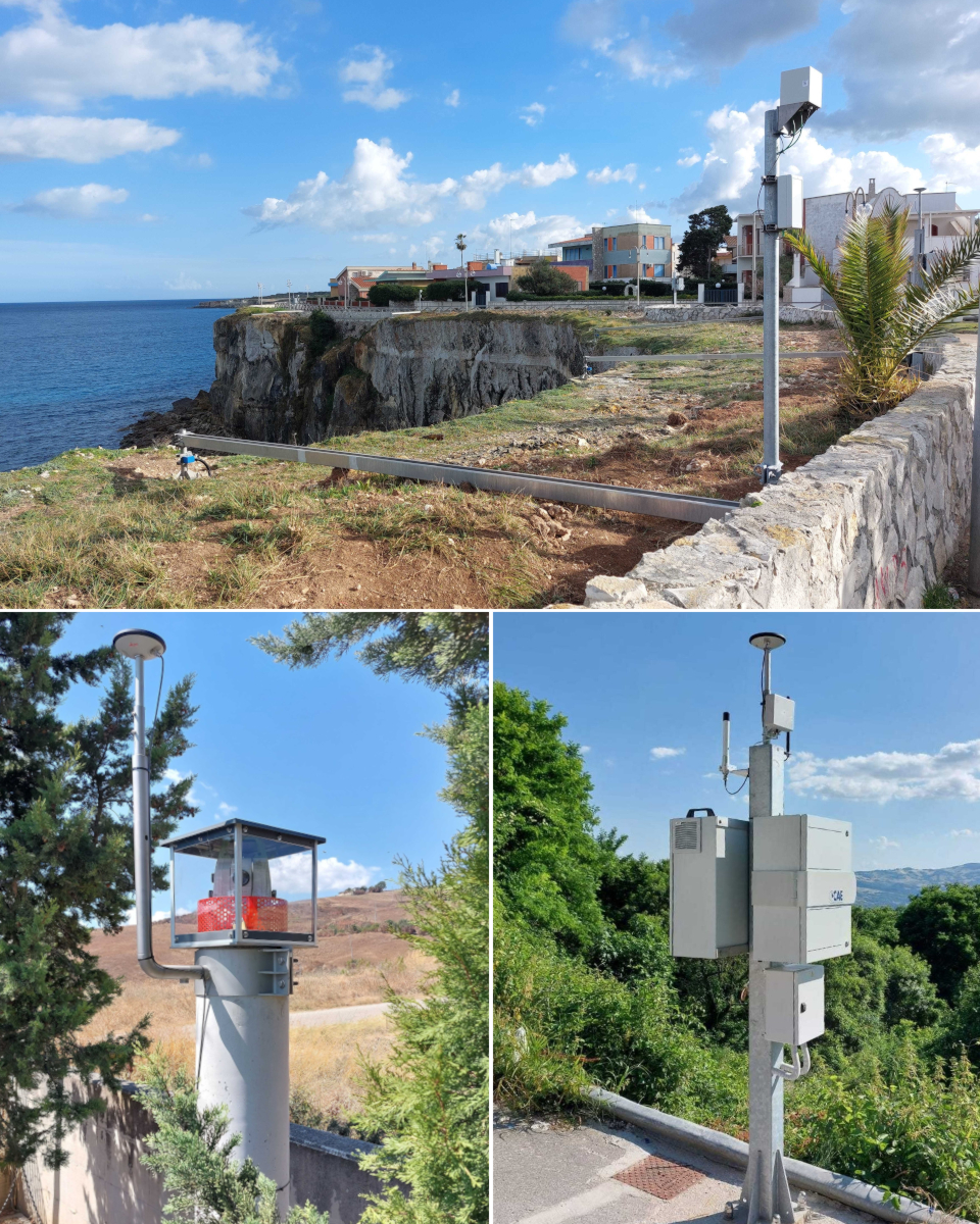
- 5 automatic weather stations, connected via GPRS and designed to aggregate data from numerous geotechnical sensors;
- 2 robotic total stations for topographic surveys, also connected to the control center via GPRS;
- a network of 19 GNSS receivers (7 Master and 12 Rover units), all linked to the control center and in constant communication with the industrial PCs installed at the various sites.
In addition, the automatic stations, equipped with Mhaster dataloggers, do not only monitor atmospheric phenomena using standard sensors such as the PG10 rain gauge and the THS thermo-hygrometer, but also integrate radio technologies (W-Point and Acti-Link), ensuring short- and medium-range connectivity. This enables the comprehensive management of:
- 9 automatic inclinometer chains;
- 36 piezometric cells;
- 21 biaxial clinometers;
- 21 instruments including crack gauges and wire extensometers.
The Control Center, located in Modugno, is equipped with a complete suite of specialized software that allows the Civil Protection Section to continuously monitor the status of the areas under surveillance.