-
 ARPAS SARDINIACase history
ARPAS SARDINIA
New regional climatological network in Sardinia
REQUIREMENTS
Sardinian Environmental Protection Agency (APAS) has launched a project to establish the “Regional Climatological Network - 1st intervention” in order to set up the first stations of a regional network to monitor some climate changes with the greatest impacts on human activities, such as global warming or the variability of rainfall and wind regimes.
The network collects useful information to support the activities of Decentralized Functional Center - Civil Protection Department, to better estimate the frequency and the characteristics of extreme weather events. The installation of the aforementioned network allows the restoration of the data related to sites in which there have once been mechanical survey stations and consequent historical data.
CHARACTERISTICS
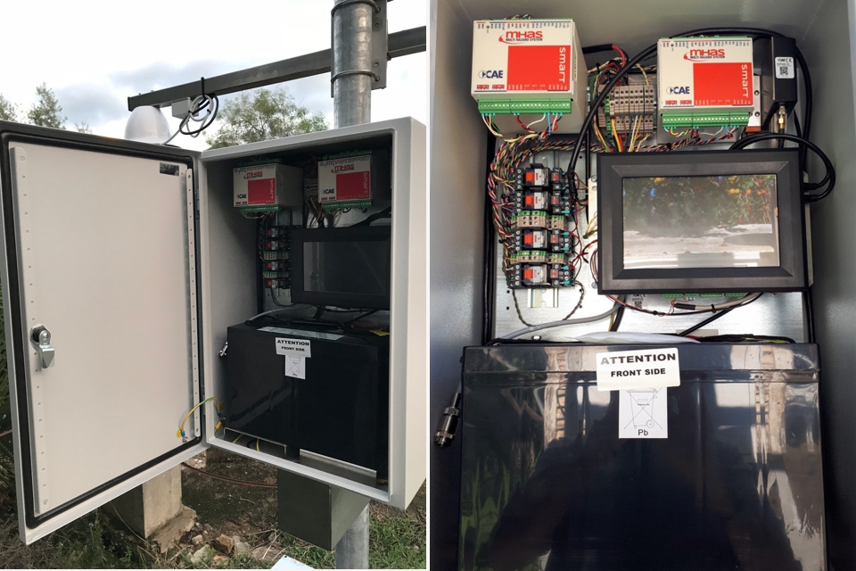
Designed with the aim of standardization and openness that identify the modern technologies “Made in CAE”, the network is composed of automatic meteorological and thermopluviometric stations that transmit the acquired data to control center in Sassari. Besides, the data is also available through Dataservice, a data export engine developed based on “Web Service” Philosophy, able to export of “raw” or aggregated and processed data.
Moreover, the project involves the implementation of software to acquire the observations related to Global Observing System (GOS) of World Meteorological Organization (WMO). Thus, the Regional Climatological Network is able to import from GOS the data of any stations belonging to Region VI (Europe), among which the data of the new stations in standard format, and Region I (Africa), provided that they are encoded as WMO specifications.
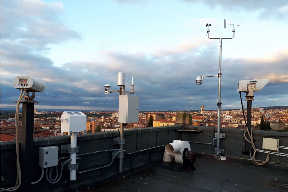
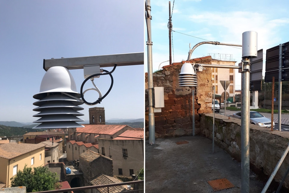
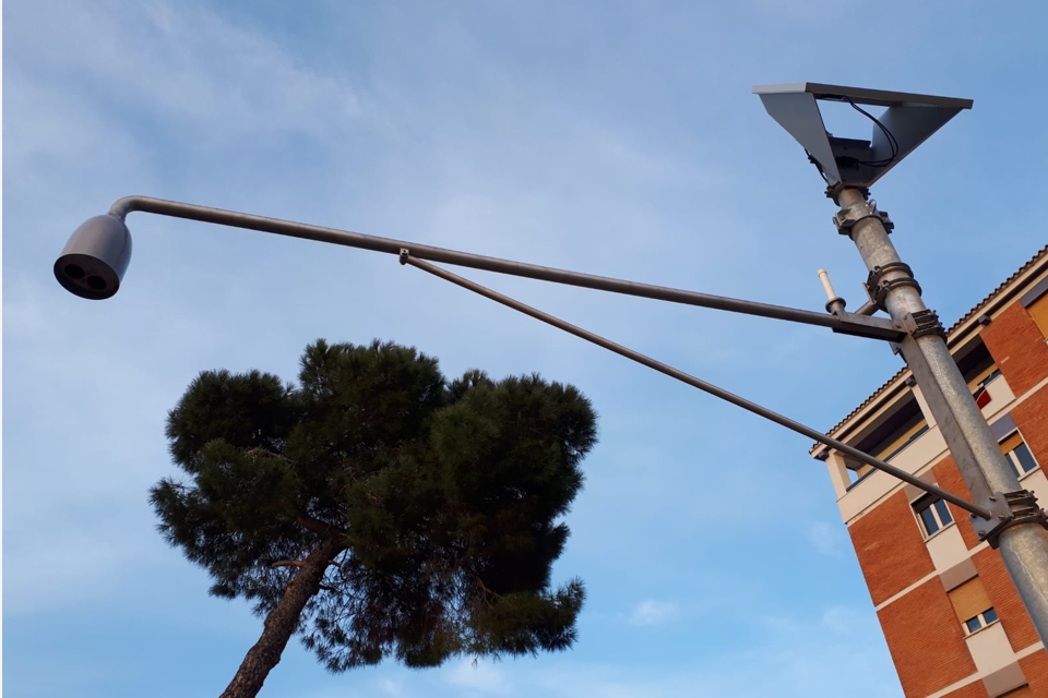
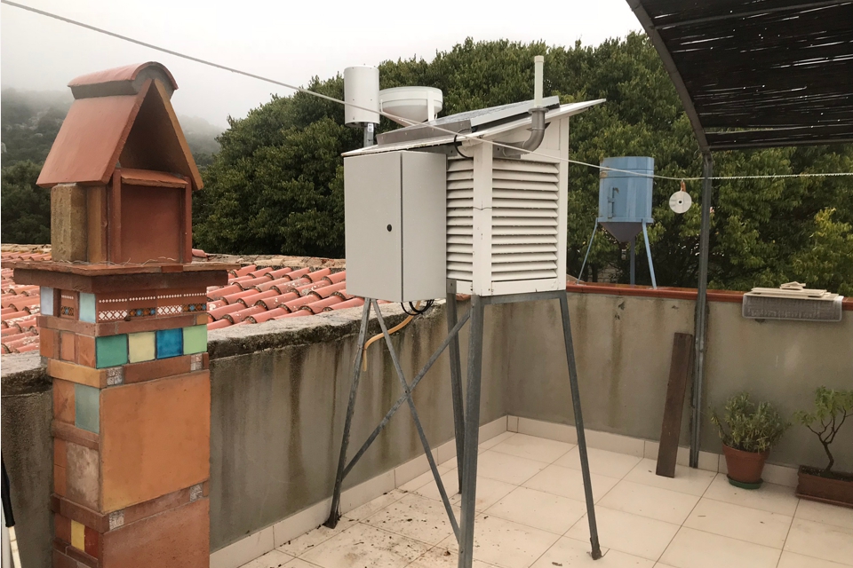
ARPAS required the utmost attention to respect the historic and artistic value of installation sites and to minimize the visual and architectural impacts thereby generated, in fact the host buildings vary from private homes to historic buildings to be preserved. As an example, Carloforte station was installed in the upper terrace of San Vittorio Tower (dating back to the XVIII century).
COMPOSITION
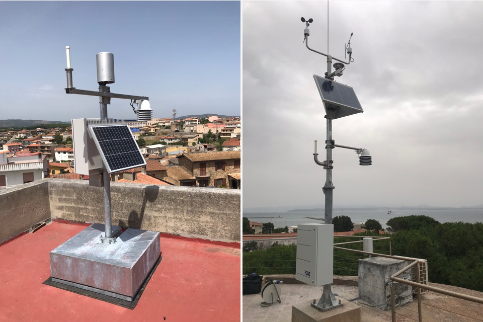
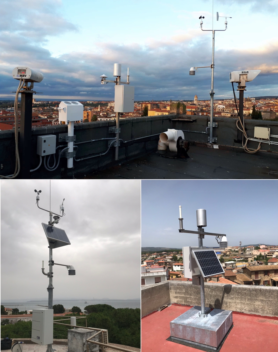
The initial core of the climatological network is composed of ten automatic stations that transmit data entirely via GPRS, with the exception of Carloforte Station which has been included in the regional network also via radio. Although this could be an element of vulnerability at real-time extreme weather events, the technology implemented is expandable in the future with additional telecommunication systems.
These ten automatic stations are divided in two types: meteorological and thermos-pluviometric stations. The former are equipped with a wide range of sensors, including rain gauge PG2, thermometer, anemometer, barometer and cloud cover sensor. The later, in one case, is also equipped with snow gauge.
To comply with the request for minimizing the visual and architectural impact, the project includes self-supporting poles that do not require tie rods. In addition, among the rain sensors, the new rain gauge PG2 is also introduced, guaranteeing not only the highest standards of precision, reliability and accuracy, but also equipped with a wide mouth of only 200 cm2 and a limited footprint, in order to minimize the visual impact.
All the equipment and services comply with the technical standards of WMO-8 Guide to Meteorological Instruments and Methods of Observation published by the WMO, of Initial Guidance to Obtain Representative Meteorological Observations Report at Urban Sites, of WMO-100 Guide to Climatological Practices manual published by WMO, as well as the quality, safety, ergonomics and communication standards regulated by Italian and European legislation, including the CE marking.