-
 ANAS S.P.A.Case history
ANAS S.P.A.
Monitoring and warning system for roads at risk of flooding in Sardinia
REQUIREMENTS
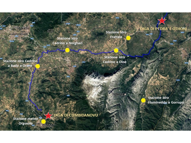
In November 2013, the passage of Cyclone Ruven, also known as Cleopatra, hit Sardinia with its load of destruction and victims. Due to climate change, the extreme events of this kind are increasingly frequent and intense. However, the hydro-pluviometric monitoring network of the upper valley of Cedrino river in the province of Nuoro showed the information deficiency in the hydrological and hydraulic processes of the catchment area and the watercourse. In particular, the lack of hydrometers upstream of the dam on the Cedrino did not allow for real-time analysis of the hydraulic risk or preventive evaluations for civil protection actions.
In 2019, CAE was awarded the contract from ANAS S.p.A. to implement a real-time monitoring network aimed at warning on the hydraulic and hydrogeological risk for Civil Protection purposes, with the focus on safeguarding those who transit on the Provincial Road SP46, an area at risk of flooding near the Cedrino River.
FEATURES
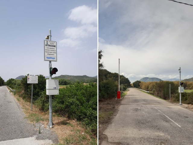
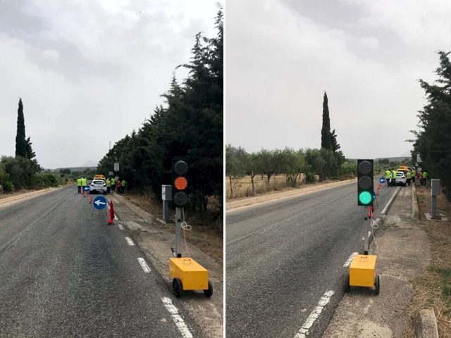
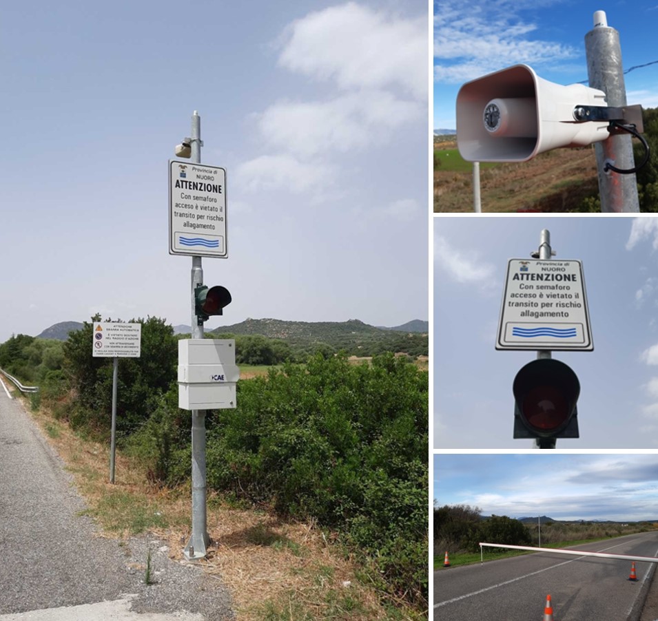
The first purpose of the system is Civil Protection: the supply and installation of automatic stations and barriers ensure in real time with maximum precision the appropriate actions regarding the opening and closing of the traffic on the provincial road SP46. In fact, the transfer time of the Cedrino flood wave between the Norgheri and the Oloè bridges is about 30 minutes: every minute is precious in the decision-making process leading to the bridge closure. In order to guarantee the safety of those who transit through this area, it is essential to apply the algorithms of CAE stations which allow the activation of traffic inhibition equipment when a certain threshold is exceeded, even without the intervention of a control centre.
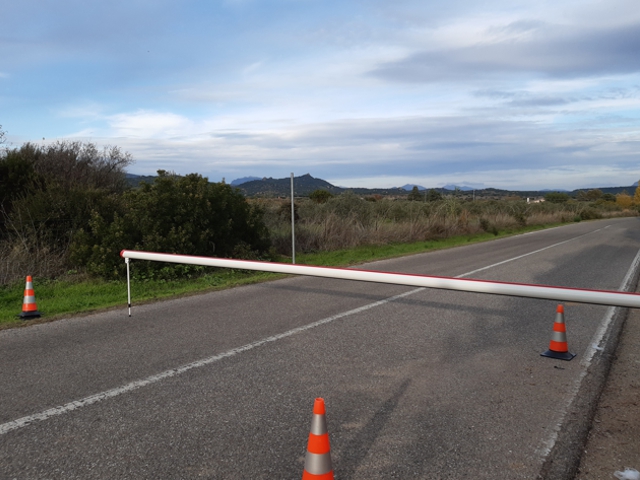
To meet the requirements of the project, CAE has created a system consisting of a series of automatic hydrometric and meteorological stations and a traffic closure system made up of automatic barriers for the vehicular transit towards the Oloé bridge when the hydrometric levels exceed the alert thresholds established by the Civil Protection Plans and the risk is high.
This system has several purposes, in particular: the meteorological station will increase the density of pluviometric information in the basin of Cedrino, while all five hydrometric stations will contribute to define the Provincial Road closure thresholds, two of these are particularly strategic, as they are directly connected to the automatic barriers. Finally, the hydrometric station of the Rio Flumineddu is important to improve the calibration of the hydrological-hydraulic model of the Upper Cedrino Basin: from this improvement follow preventive assessments of calibration and forecast of flows and volumes flowed from Lake Pedra 'e Othoni, in addition to further considerations regarding the alert system of the Lower Cedrino area.
COMPOSITION
The system is composed of:
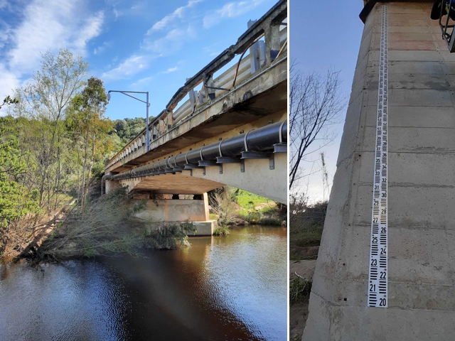
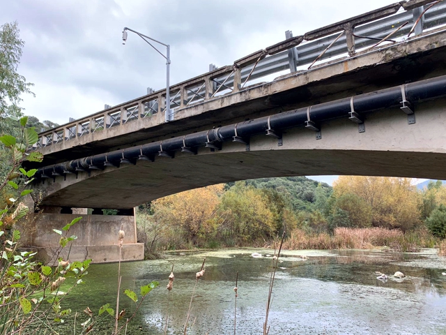
- n. 5 automatic hydrometric stations in telemetry and with staff gauges;
- n. 1 meteorological station;
- n. 2 automatic road barriers;
- Automatic alert: SMS, sirens, warning signs, traffic light
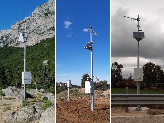
All the stations are equipped with a Mhaster Datalogger open source, based on Linux operating system, an autonomous power supply thanks to solar panels and a double real time data transmission system, both via radio communication towards the existing Regional Radio Network managed by ARPAS/SASI and through the GPRS/UMTS module, ensuring the reliability of the performance even in extreme weather conditions.