-
 NewsTechnological innovation in the monitoring of water flows: the new theory of reference has been implemented
Technological innovation in the monitoring of water flows: the new theory of reference has been implemented
May 2016
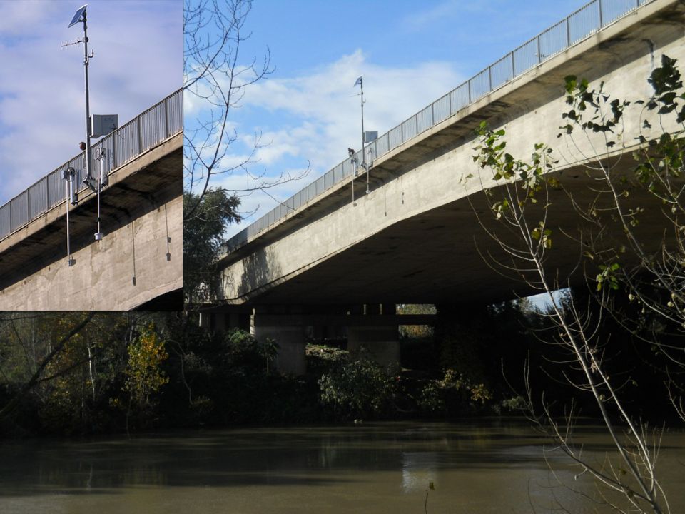
CAE’s Guido Bernardi and Engineers Francesco Mele and Domenico Spina from the Functional Centre of Civil Protection of the Lazio Region co-wrote a scientific paper called “Radar systems for monitoring levels and water flows of the river network of the Lazio Region”. The article represents a junction point between theory and operational practice in the real time monitoring of water flows and is available for reading – in Italian – at this link on the first issue of “L’acquaonline”, the Italian Hydrotechnical Association.
The article discusses how the Lazio Region, asking CAE to implement highly innovative technologies in its regional network, has experimented with the theoretical model of water flows measurements already studied by the company in collaboration with Professor Ezio Todini from the University of Bologna (Alessandrini, V., Bernardi, G., and Todini, E., [2013] - An operational approach to real-time dynamic measurement of discharge. Hydrology Research, 44.3: 953-964). This implementation allows, as a result of an initial calibration of site-specific parameters, to estimate the average speed of the flow inside the measuring section, starting from the superficial velocity data obtained through radar sensors, and to combine them with the wet area for each water level measured, returning a reliable real-time measurement of the flow at the installation site.
The implemented system provides:
- the real time measuring of water flows with an improvement in the accuracy in the determination of the same;
- the recognition of the flood peak;
- the measuring of the speed as a precursor of the flood peak;
- the highlighting of the significant changes in the riverbed’s geometry in the measuring section;
- a correct measuring even in the presence of sediments on the bottom,
all of this by using a technology not immersed in water, which greatly reduces the risk of failure and the need for maintenance.
The network provided by CAE to the Lazio Region has increased the existing hydro-meteorological one; 10 sites have been created for the measurement of water flows: they have been deployed in the territory, in order to bring tangible improvements in the framework of an information database which is preparatory to the decision-making process, and to increase the stability of data and the limitation of the oscillation of the same. The sites in question are: Terria, Stimigliano, Ponte del Grillo, Foro Italico, Ponte Mammolo, Madonna della Pace, Sora, Ceccano, Pontinia and Cassino.
This system, like all those designed by CAE, has the fundamental objective of enabling the performance of complex activities and procedures meant to support risk mitigation and to allow maximum sharing of information among all parties involved in monitoring and prevention activities. The continuous use of the system demonstrates the accuracy of the measures through regular audits in the field. It was also verified that in some sites (Liri in Madonna della Pace) the increase of the speed of the stream monitored can be a useful precursor (an average of two hours) for the flood alert.