-
 NewsPNRR – MASE Implements the Integrated Monitoring and Forecasting System (SIM)
PNRR – MASE Implements the Integrated Monitoring and Forecasting System (SIM)
June 2026
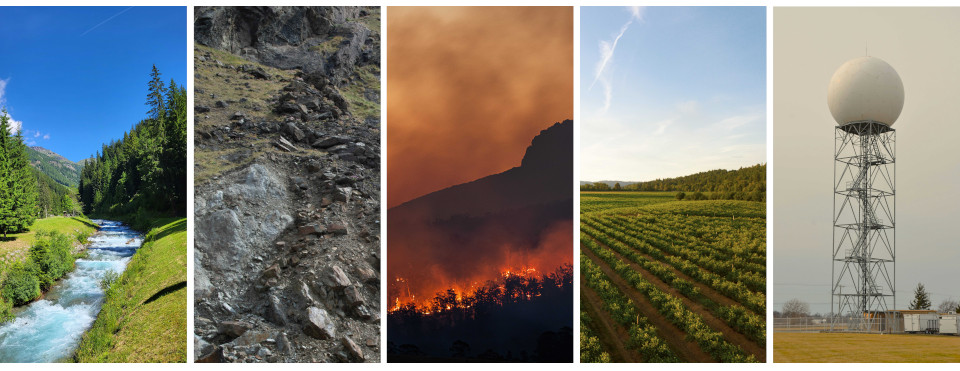
As part of the National Recovery and Resilience Plan (PNRR) Investment M2C4 I1.1, the Italian Ministry of the Environment and Energy Security (MASE) has launched the implementation of the Integrated Monitoring and Forecasting System (SIM), aimed at developing a system capable of identifying and forecasting risks affecting the national territory, including those related to climate change.
The SIM is based on a series of interoperable federated systems that integrate existing observation networks with new technologies, ensuring standardized management of processes, data, and models. Its core components include the collection and harmonization of territorial data through satellite observation, drones, and remote sensing technologies, the integration of existing information systems, continuously operating telecommunications networks, central and regional control rooms, and cybersecurity systems and services.
The SIM project is broad in scope and comprehensive in nature. It consists of a large-scale programme involving forty public administrations and is structured around two main areas of intervention:
1. Making environmental monitoring data accessible and shareable: through a single access point, users will be able to access an extensive volume of information generated by a constellation of environmental monitoring systems;
2. Integrating and enhancing the monitoring networks already used to collect environmental data, including information on air quality, wildfires, landslides, and water quality.
This article focuses on the second area of intervention, for which the procurement procedure included the modernization, enhancement, and integration of the following monitoring networks distributed throughout the national territory:
- Radar Network, an integrated national infrastructure that collects and processes data from weather radars distributed across the country.
- HydroMeteo Network, dedicated to monitoring the main meteorological, rainfall, and hydrometric parameters.
- In Situ Landslide Monitoring Network, designed to monitor landslide bodies, define warning thresholds, and help safeguard people and assets.
- Seismic Network, consisting of the National Accelerometric Network (RAN) and the Seismic Observatory of Structures (OSS), responsible for recording ground motion and assessing its effects on buildings.
- High-Precision Levelling Network, Italy's national vertical reference network managed by the Italian Military Geographic Institute (IGM). It comprises approximately 13,000 benchmarks distributed along an equivalent number of kilometres of the country's main road network.
- AgroMeteo and Greenhouse Gas (GHG) Network, dedicated to monitoring agrometeorological variables and greenhouse gas fluxes.
- National Dynamic Network, the country's geodetic infrastructure for high-precision monitoring of the official national reference frame. A network of permanent stations continuously observes GNSS satellite signals and transmits them electronically to a central processing facility.
- Wildfire (Meteorological) Network and National Gravimetric Network, dedicated respectively to wildfire prevention monitoring and the measurement of variations in the Earth's gravity field.
- Additional monitoring equipment, including air and marine sensors, meteorological sensors, environmental monitoring instruments, mobile photovoltaic panels, and drones.
Another key objective of the project is to make all of these monitoring networks fully interoperable with the SIM. This represents a major national infrastructure initiative that significantly strengthens Italy's capability to forecast, prevent, and manage environmental risks.
The temporary consortium awarded the contract, of which CAE is a member, has signed a single framework agreement with MASE covering the management of activities related to all of the monitoring networks described above.