-
 NewsLombardy, Italy: the new remote monitoring system for landslides is "made in CAE"
Lombardy, Italy: the new remote monitoring system for landslides is "made in CAE"
December 2015
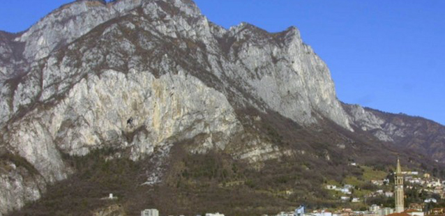
Advanced systems, interoperability and redundant telecommunications are the main features of CAE's early warning monitoring systems to be installed on 18 landslide sites in Lombardy, Northern Italy.
"We are very pleased, and we somehow feel as pioneers, because there are very few examples of such complete and integrated projects for the real-time monitoring of landslides" said Guido Bernardi - chief of New Markets Development at CAE S.p.A. - while announcing that his company had been awarded another very important contract, this time by Lombardy's Regional Environmental Protection Agency (ARPA).
The project is to create the most extensive remote monitoring system for landslides in Italy, a network widespreading throughout Lombardy, using fully interoperable technologies and integrating both existing and new instruments in innovative ways. "It's a challenging job, and CAE is going to face it with the usual enthusiasm and professionalism, helping to increase the safety of citizens", Bernardi added.
Subject of the tender are the technological upgrading and improvement of ARPA's monitoring networks operating in 18 areas of instability within the region of Lombardy. The monitoring systems will in fact be put on remote control for the first time. In addition to these new deployments, the project includes the maintenance of the geotechnical monitoring equipment already installed in another 19 landslide areas and 36 existing weather stations.
Together with the partners with whom CAE associated to provide an even broader range of skills, the Company will be responsible for the remote monitoring of conventional geotechnical sensors, such as strain gauges, crack gauges or inclinometers, sometimes coupling their measurements with those of meteorological sensors such as rain gauges, thermometers and snow gauges. Furthermore, the project will include measuring to be implemented with topographical equipment, such as "total stations" and GPS receivers working continuously. Thanks to all this network technology, ARPA's operators will have complete, up-to-date and reliable information to use for their best interpretation of events in each of the areas of instability.
The various field installations, as well as being individually accessible at any time, remotely transmit the detected data with a standard FTP protocol, depositing them on one of ARPA's servers.
"The main strength of our monitoring systems - Bernardi explains - can be represented by the massive use of redundant telecommunications for dialogue between the stations and central control. In this case, ARPA's choice supports the use of both GPRS and a satellite backup, both technologies suited to convey messages via standard FTP. Another strength of our offering is the equally massive use of local wireless networks for the management of networks of geotechnical sensors on various landslides, granting a considerable simplification of the field installation operations and a resulting increased efficiency for public administration".
For 11 areas of those with new installations, the temporary partnership with other companies will produce a geotechnical modeling of the instability conditions, defining the event scenarios, the areas potentially affected by the evolution of the phenomenon and three threshold levels of increasing criticality for the alert system.
Bernardi concludes: "Ours is an integrated project which combines automatic geotechnical and meteorological monitoring, with modeling services for single landslides and even manual monitoring with different technologies. The entire work will last about two years and will continue for a maintenance period, and it is being launched in a few days".