-
 CIVIL DEFENSE OF MOLISECase history
CIVIL DEFENSE OF MOLISE
A MONITORING AND EARLY WARNING SYSTEM FOR THE LANDSLIDE IN CIVITACAMPOMARANO (CAMPOBASSO)
REQUIREMENTS
After the huge landslide occurred in the Municipality of Civitacampomarano, an automatic monitoring and early warning system in real time has been implemented and tested, aiming at guaranteeing public safety and managing the emergency situation.
FEATURES
The system allows to automatically and uninterruptedly monitor the area, in order to create a large database that, after an appropriate data processing and correlation, will allow the municipal technicians and the regional staff to:
- evaluate the behaviour of the monitored area during and after significant meteorological events;
- obtain the necessary knowledge in order to manage any future emergency;
- plan and examine any possible strengthening interventions that might become necessary, and test their effectiveness.
Apart from the monitoring data collection, the system also performs many alert functions, that are essential when a landslide occurs in inhabited areas like this. Particularly, 3 automatic scenarios can be defined: normality, pre-alarm and alarm. The activation of these scenarios is functional to the rainfalls level and the landslide movements, measured by the movement of the sensors, whose alert threshold can be set on a different level for each network sensor. When an intense rainfall phenomenon occurs, the pre-alarm scenario is activated and the number of measurements for the data acquisition automatically increases. Moreover, when at least 1 sensor indicates some sort of stress (inclination/opening) that exceeds the alert threshold, the alarm setting is activated and notifications are sent via SMS/vocal message/Fax/Mail to the staff. The client is free to set the system so that these notifications are sent even when a pre-alarm scenario is activated.
COMPOSITION
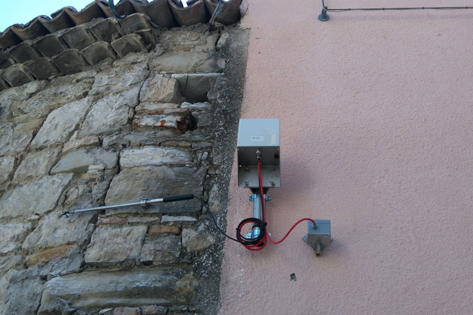
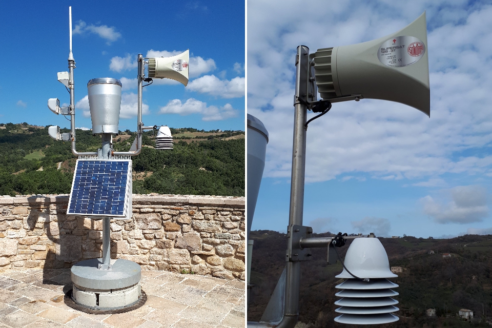
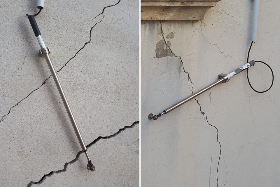
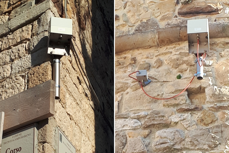
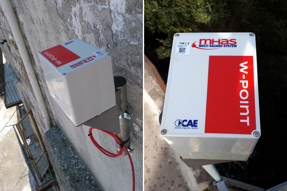
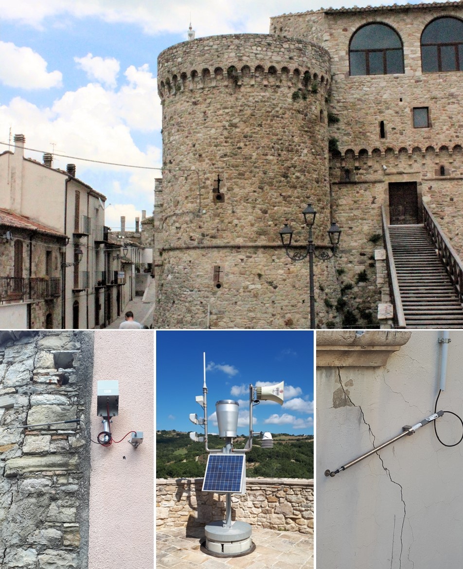
The multi-risk station (Mhaster), that depends on the system, is installed in the imposing Angionino Castle that overlooks the town threatened by the landslide. This station is equipped with an air thermometer and a rain gauge that allow us to associate the evolution of the instability to the rainfalls on the spot, which are the main priming phenomenon of the instability itself. Moreover, the station collects the data registered by all the geotechnical equipment, which consists of crack width gauges, surface clinometers, piezometric devices and manual inclinometers.
The sensors installed near the red zone, which has been evacuated, communicate with the station through a Self-Reconfigurable Wireless Mesh Network, that makes the system highly adaptable and allows us to easily and quickly modify the position of the sensors in order to adapt it to the changes occurring on the landslide.
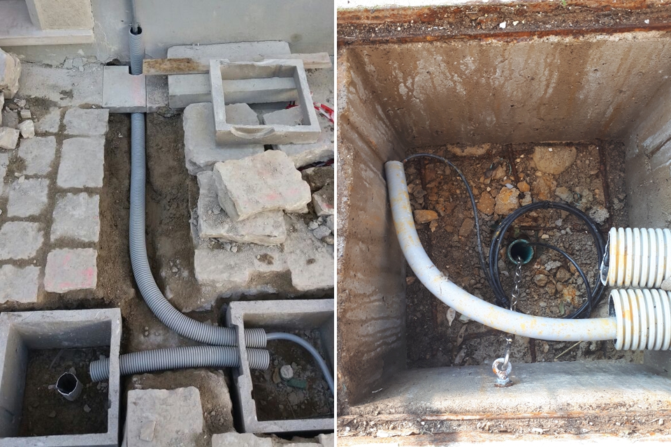
The data are transmitted through a duplex communication system consisting of a GPRS/UMTS module and an UHF band radio device; this way, the station is connected to the remote measuring radio network of the Civil Protection System. Apart from being sent to the Functional Centre of the Civil Protection System and to the Municipal Operative Centre (C.O.C. - Centro Operativo Comunale), where the headquarters for the data acquisition and visualisation has been installed permanently, the data are also available on a WEB platform accessible through an internet browser.
As any other CAE device installed for the Civil Protection System, the above-described system works H24 in any sort of environmental operating conditions, due to:
- its automatic diagnostic functionalities, that allow us to check on its operating status remotely and in real time;
- its energy independence. Each element of the monitoring system is energetically autonomous, thanks to the use of solar panels and batteries that allow us to avoid any possible malfunctions caused by possible blackouts that might occur in the area.